Draining Nepal’s Dangerous Glacier Lake
The Nepal government announced it had finished draining the Imja glacier lake in Everest region on 23 November.
Imja lake was in danger of flooding villages, bridges and trekking trails downstream.Imja lake is one of the six highly dangerous glacial lakes in Nepal.It took more than six months for about 150 people including 40 military personnel and local Sherpas to construct an outlet and release almost four million cubic metres of water. The water level of lake–originally 149 metres deep – fell by 3.4 metres.
Nepal has thousands of glacier lakes. Many of these are filling up fast because of warming temperatures and melting glaciers. Glacier lakes have burst their banks 24 times in Nepal since the 1960s, three of which were in the Dhud Koshi river basin in the Everest region.
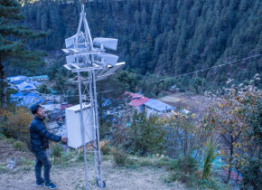
The Nepal government set up flood risk reduction project, supported by the Global Environment Facility and United Nations Development Programme. Early warning systems have been installed in six settlements on the Everest trekking trails to send flood warnings to people downstream. Tourists have suggested the government shift trails on Everest to higher places so trekkers and porters climbing the mountain are safe from potential glacier lake floods.
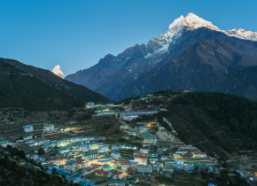
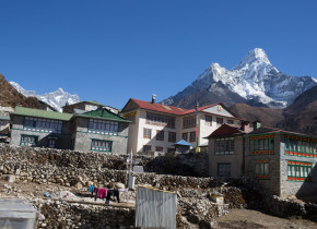
- Namche Bazaar during evening, the getway to Everest. Solukhumbu District, Nepal.
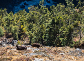
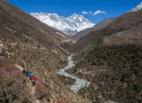
- Bidiversity in Everest Region, Solukhumbu District, Nepal. Dhud Koshi River flows through the gorge these mountains.
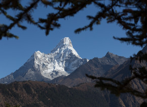
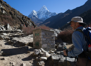
- Ama Dablam, 6812m from sea level, is one of the most beautiul mountains that tourists see and enjoy during the treeking to Everest Base Camp from Namche Bazaar, Solukhumbu District, Nepal.
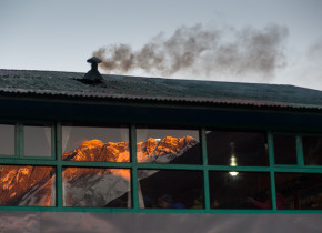
- Smoke emited from a hotel in Debuche as the sun sets in Mt. Everest is reftected in the glass of dianning room. The smoke comes from the heating system for the dianning room. Recent study has shown that black carbon from such smoke is also cause for faster retreat of glaciers in Himalaya Region. Solukhumbu District, Nepal.
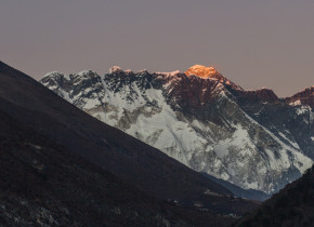
- Last sun light seen on Mt. Everest peak( M), 8848m from sea leavel, as sun sets in Everest area from Debuche, Solukhumbu District , Nepal
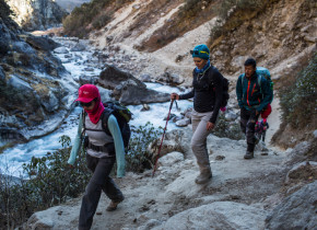
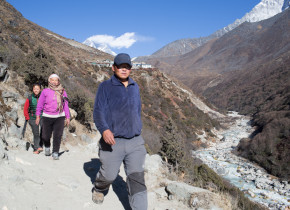
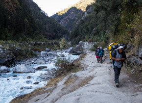
- Tourists with their guide trek on the trail by the side of Imja River in Solukhumbu District, Nepal. Thausands of toursts guide are earn theirs liveihood in Everest Region due to the tourism. Many tourists and goide are also unaware of the threat posed by the Glacial Lake upstream.
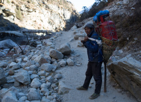
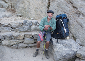
- Tinkuli Rai, porter, rest by the side of Imja River in Solukhumbu District, Nepal. Thausands of porters are earn theirs liveihood in Everest Region due to the tourism. The porters are also unaware of the threat posed by the Glacial Lake upstream.
- A happy tourist trek on the trail by the side of Imja River in Solukhunbu District. The mountain is Ama Dablam, 6812m from sea level, is one of the most beautiul mountains that tourists see and enjoy during the treeking to Everest Base Camp from Namche Bazaar.
- Early warning system intslled in the middle of lower Pangboche Village . The early warning sytem will get autmated warning message from Automated Hydromet Sensor installed in Imja Glacial Lake. Phungithanka village, Solukhumbu District, Nepal.
- Trekers walk by the trail on Imja Valley. Pangboche, Solukhumbu District, Nepal. Due to climate change , increasing glacial lake upstream pose a threat to the down stream valley.
- Locals walk by the trail on Imja Valley. Pangboche, Solukhumbu District, Nepal. Due to climate change , increasing glacial lake upstream pose a threat to the down stream valley.
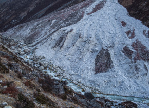
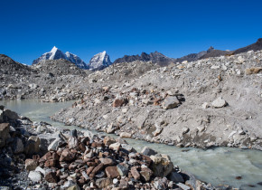
- Deberis flow from othre glacial rivulet that feeds to Imja River in the Everest Region. Such debris from othre glaciars adds more risk on the flashflood on the Imja River Valley. Solukhumbu District, Nepal.
- Ranjita Rai works as a labourer with her husband in Dengboche Village, the way to Imja Glacier and Everest Base Camp. She was really worried last year when a small flash flood tiggred from other glaicial lake that mixed with imja river, althrough ,it only destroyed one bridge near Dengboche. Solukhumbu District Nepal.
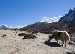
- A Chauri (Yak) graze in the Imja River Valley. The Imja River valley also frazile grazing land for thausands of livestock which are vulnarable to the changes that are due to climate change. Solukhumbu District Nepal.
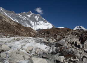
- Glecial melt water flow in the frizile Imja valley in Chukin, at Solukhumbu District Nepal.
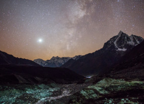
- A night view of frizile Imja River Valley from Chukum, Solukhumbu District, Nepal.
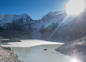
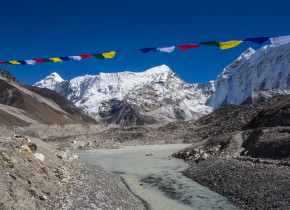
- The front part of frizile Imja Glacial Lake. located at the altitude of 5010m above sea lavel, Imja Glacial Lake is one of the potentially dangerious lake in Nepal Himalaya. The rist of outburst is lowered by lowering the water level of the glacial lake by 3.4 meters. Everest Region, Solukhumbu District Nepal.
- Aaang Sona Sherpa from Dengeboche Village came to Imja Lake today to attend the completion ceremony of much-awaited Imja Lake Lowering Project. 23 November 2016
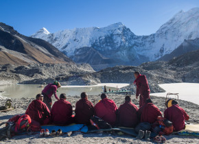
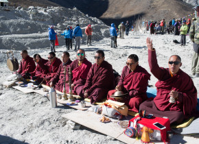
- Local Monk from Everest region perform religious retuals during the completion ceromony of much-awaited Imja Lake Lowering Project. 23 November 2016
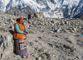
- Kalma Lama, from lukla, runs a shop in Dengboche. She is happy that the risk from the lake is lowered by lowering the water level of Imja by 3.4m. She is here in Imja Lake today to attend the completion ceremony of much-awaited Imja Lake Lowering Project. 23 November 2016. She has already experience samall glacial lake outburst flood that tiggred from Lotse Glacier last summer. She says, ” Althrough there was no lose the flow of flood in the Imja River was terrifiying. Imja Lake, Everest Region, Dolakha District Nepal
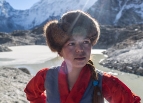
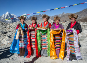
- Sherpa women in their traditional atire to wellcome delgates on Imja Lake today for the completion ceremony of much-awaited Imja Lake Lowering Project. 23 November 2016
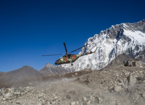
- An army helicopter fly near the imja lake during the completion ceromony of much-awaited Imja Lake Lowering Project. 23 November 2016
- Local Monk from Everest region perform religious retuals during the completion ceromony of much-awaited Imja Lake Lowering Project. 23 November 2016
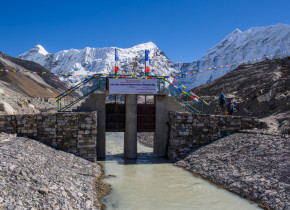
- The controlled exit cannel built by Nepal Army in Imja Glacial Lake. The lowering project has tried its best to use locally available materials to make the cannel. Everest Region, Solukhumbu District Nepal.
- The controlled exit cannel built by Nepal Army in Imja Glacial Lake between big and small lake lake part. The lowering project has tried its best to use locally available materials to make the cannel. Everest Region, Solukhumbu District Nepal.
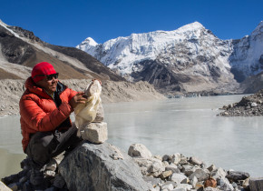
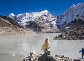
- Pasang Sherpa, Tamakhani VDC, Solukhumbu has climb Everest for 6 times. He belives that there are such other lakes, that poase the same kinds of risks in the Nepal Himalaya. He offers religious “Khada’ to stone “Mani” constructed infront main Imja Glacial lake on the the completion ceromony of much-awaited Imja Lake Lowering Project. 23 November 2016 . Solukhum
- The frazile Imja Glacial lmja Lake, one of the biggest glacial lakes in Everest Region of Nepal Himalaya. It is located at an altitude of 5010 meters above the sea level. Till 1960 there were small lakes in Imja Glacier. But dut to rise in temperature bacause of climate change, the lake has incresed to 1.28 square kilometers now. The depth of the glacial lake is 150 meters. Dolakha District , Nepal
- The controlled exit cannel built by Nepal Army in Imja Glacial Lake. The lowering project has tried its best to use locally available materials to make the cannel. Everest Region, Solukhumbu District Nepal.
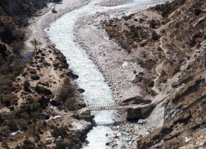
- A vulnerable bridge in Dhud Koshi River near in Pangboche, Solukhumbu District, Nepal. Due to climate change , increasing glacial lake upstream pose a threat to the down stream valley.
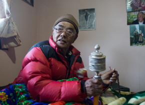
- Kancha Sherpa, the only living team member of the first successful Everest Expedition led by Sir Edmund Hillary and Tenzing Norgay Sherpa back in 1953, at his House in Namche Bazaar. He says, “In Everest Region there was much snow, it is gradually decreasing since my first everest experience”. Solukhumbu District, Nepal.
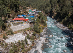
- A settlement in Jorsalle on the flood plain of Dhud Koshi River, Solukhumbu District, Nepal. Due to climate change , increasing glacial lake upstream pose a threat to the down stream valley.
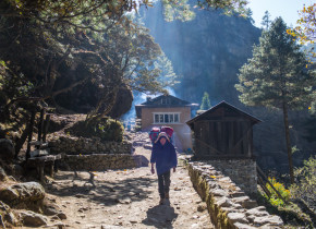
- A porter carry lauggage of tourist near Manjo Village on the way to everest. Thausands of porter earn their living in Everest Region by carrying goods on their back. Solukhumbu District, Nepal.
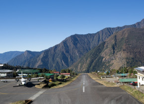
- A view of Tenzing Hillary Airport in Lukla, Solukhumbu District. The airport is one of the getways to Everest Region, Nepal.
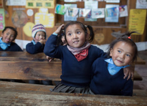
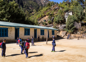
- Students of Shree Pema Chholing Primary School, Chourikharka, 6, Ghat. Solukhumbu District, Nepal. The school has been identified as Safe Evacuation Centre by Community Based Flood and Glacial Lake Risk Reduction Project if any Glacial Lake Outburst Flood happens upstream in Dhud Koshi River basin.
- Students of Shree Pema Chholing Primary School, Chourikharka, 6, Ghat. Solukhumbu District, Nepal. The school has been identified as Safe Evacuation Centre by Community Based Flood and Glacial Lake Risk Reduction Project if any Glacial Lake Outburst Flood happens upstream in Dhud Koshi River basin.
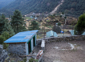
- Toilets built for the purpose of safe evacuation centre at Shree Pema Chholing Primary School by Community Based Flood and Glacial Lake Risk Reduction Project. Chourikharka, 6, Ghat. Solukhumbu, Nepal.
- Nang thume Sherpa, member of Task Force for Glacial Lake Outburst Flood risk reduction shows the early warning system intslled in Fakding Village Solukhumbu, District Nepal. The early warning sytem will get autmated warning message from Automated Hydromet Sensor installed in Imja Glacial Lake.
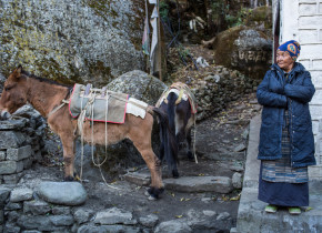
- Pasang Lahmu Sherpa, 60, from Fakding Village is aware of the the early warning system intslled in Fakding Village Solukhumbu, District Nepal. The early warning sytem will get autmated warning message from Automated Hydromet Sensor installed in Imja Glacial Lake.
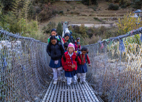
- School children cross a suspension bridge over Dhud Koshi River near Fakding Village where the early warning system is intslled, Fakding Village Solukhumbu, District Nepal. The early warning sytem will get autmated warning message from Automated Hydromet Sensor installed in Imja Glacial Lake.
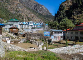
- Hotels for trekking tourism on the floodplain of Dhud Koshi River in Chaurkharka, Fakding Village, Solukhumbu District Nepal. Millions of dollars has been invested by local people to built hotels for tourist. Glacial Lake upstram poses a threat to such huge investment downstream.
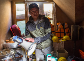
- Lakpa Themba Sherpa from Chaurkharka VDC, Banker, member of task foce reduction shows the equipments for first aid and light search and rescue supported by community based Glacial Lake Outburst Flood risk reduction project in Solukhumbu, District Nepal.
- Students at Shree Yuba Barsa Lower Secondary School, Chaurikharka, Manjo.The school has been identified as Safe Evacuation Centre by Community Based Flood and Glacial Lake Risk Reduction Project if any Glacial Lake Outburst Flood happens upstream in Dhud Koshi River basin. Toilets and drinking water suply is built for the Evacuation Centre. Solukhumbu District, Nepal.
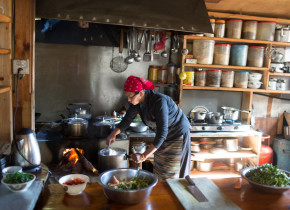
- A Sherpa women prepares lunch for touristat her Hotel on the flood plain of Dhudkodhi in Jorsalla, Chaurikharka. Due to climate change, glacial lakes that are formed upstream poses a threat to her life and livelihood. Solukhumbu, District, Nepal.
- A porter and tourists trek by the side of Dhudkodhi River in Jorsalla, Chaurikharka. Due to climate change, glacial lakes that are formed upstream poses a threat the trekers on the Everest Region, Solukhumbu, District, Nepal.
- Micogovinus, a Cubian origin American Citizen, 64, on the trek to Namche Bazaar in Evesrest Region , Solukhumbu District, Nepal. He suggests to make trails in higher places so that tourists treeking on the Everest Region get rid of the threat posed by the Glacial Lake Outburst Flood.
